Billie Silvey
| The Lay of the LAND |
June 2007
In 1803, the Louisiana Purchase doubled the land mass of the
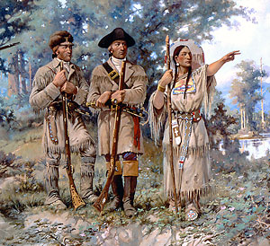
United States. The next year, President Thomas Jefferson sent
Meriwether Lewis and William Clark to explore the new
acquisition. One of his aims was to map the new Northwest
territory, a vast empty space on the map of the time. He was
hoping Lewis and Clark would find a water route across the
continent.
Jefferson, an avid geographer, had collected the best maps and
information available and passed them along to the explorers.
But Jefferson and most other geographers of the time were
unaware
of the size and extent of the Rocky Mountains. They assumed
that the source of the Missouri River lay in a low range of hills
in the northwest of the new territory, and that the Columbia
flowed the opposite direction not far away.
However, the Rockies soared much higher and had sharper,
more jagged peaks than they expected. Many were
snow-capped all summer, and they were over 300 miles
across in places. As Lewis and Clark followed the river uphill
into the Rockies, they found their path blocked by an
incredible series of waterfalls--40, even 50 feet high. It took
12 days to carry everything around them.
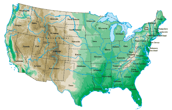
What they needed was a topographic map, or a map that
indicates the contours of the land, the height of mountains and
the depth of passes and canyons. Topographic maps use
various colors and shading to represent various altitudes.
United States. The next year, President Thomas Jefferson sent
Meriwether Lewis and William Clark to explore the new
acquisition. One of his aims was to map the new Northwest
territory, a vast empty space on the map of the time. He was
hoping Lewis and Clark would find a water route across the
continent.
Jefferson, an avid geographer, had collected the best maps and
information available and passed them along to the explorers.
But Jefferson and most other geographers of the time were
unaware
of the size and extent of the Rocky Mountains. They assumed
that the source of the Missouri River lay in a low range of hills
in the northwest of the new territory, and that the Columbia
flowed the opposite direction not far away.
However, the Rockies soared much higher and had sharper,
more jagged peaks than they expected. Many were
snow-capped all summer, and they were over 300 miles
across in places. As Lewis and Clark followed the river uphill
into the Rockies, they found their path blocked by an
incredible series of waterfalls--40, even 50 feet high. It took
12 days to carry everything around them.
What they needed was a topographic map, or a map that
indicates the contours of the land, the height of mountains and
the depth of passes and canyons. Topographic maps use
various colors and shading to represent various altitudes.
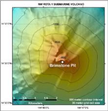
The latest
topographic
maps,
bathymetric maps,
indicate the depths
of the oceans. At
right is a map of
an undersea
volcano.
topographic
maps,
bathymetric maps,
indicate the depths
of the oceans. At
right is a map of
an undersea
volcano.